Complete Guide to Trekking in Bhutan: Routes, Costs, Permits & Best Time (2025–2026)
By Karma Wangchuk · June 27, 2026 · 28 min read
When you fly into Paro — descending in tight spirals between mountains that seem close enough to touch — you get your first honest look at what Bhutan actually is. Not a city-state. Not a resort. A mountain kingdom, deeply and irrevocably shaped by the peaks, ridges, valleys, and passes that surround every settlement, every monastery, every rice field.
To understand Bhutan fully, you have to walk it.
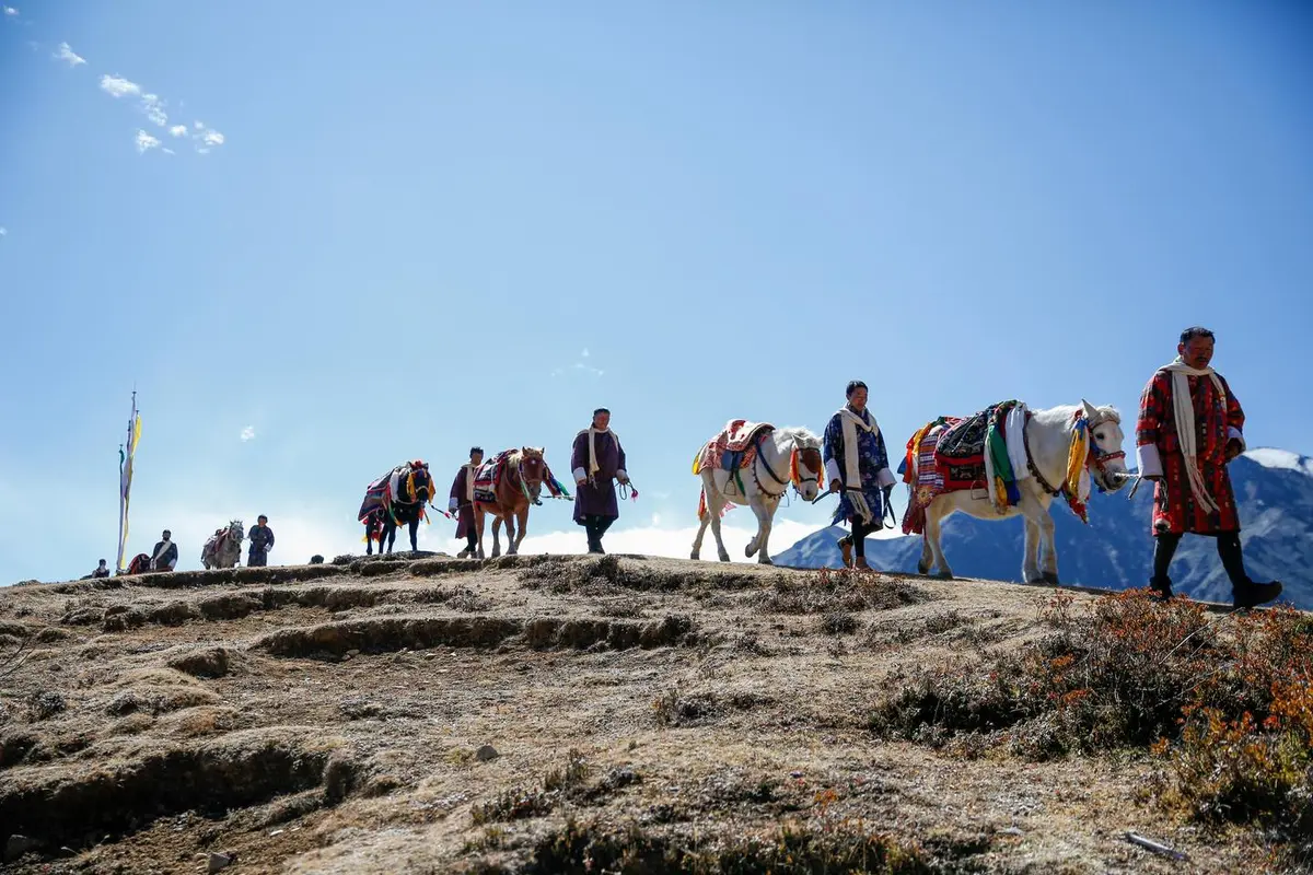
The country has more than 50 mapped trekking routes, ranging from a 45-minute nature ramble above Thimphu to the Snowman Trek — a 25-plus-day expedition through the Lunana wilderness that sits comfortably among the most challenging long-distance treks on Earth. Between those poles lies an extraordinary spectrum: lake treks that top out above 4,000 metres, valley walks through rhododendron forests so dense the sky disappears, pilgrimage routes to cliff-face monasteries, and cross-country trails that connect dzongs and villages along paths worn smooth by centuries of foot traffic.
This guide covers all of it. Routes, costs, permits, seasons, gear, and the practical realities that most travel content glosses over.
Why Trek Bhutan? What Makes It Different
Most countries let you hike freely. You buy a map, lace up your boots, and go. Bhutan doesn't work that way — and the restrictions that might initially feel frustrating are precisely what make trekking here extraordinary.
Genuine wilderness. Bhutan has maintained over 70 percent forest cover and protects more than 51 percent of its land area as national parks, wildlife sanctuaries, and biological corridors. Many trekking routes pass through terrain where the last human visitor may have been weeks earlier. You will share trail space with blue sheep, Himalayan black bears, and possibly snow leopards.
Living Buddhist culture on the trail. The treks pass through landscapes still actively shaped by a 1,000-year tradition. Prayer flags on every pass. Chortens at every junction. Monasteries perched on impossible cliff faces. Villages where monks bless your departure and farmers tell you which passes the yaks crossed last week.
No trekking crowds. Even the famous routes — Jomolhari, Druk Path — carry a fraction of the foot traffic you'd find on comparable Nepali trails. In high season on the Annapurna Circuit you might share campsites with 100 other trekkers. On the Jomolhari in October, you might share one.
Mandatory guides who actually know the mountain. Every licensed Bhutanese guide has grown up in this landscape. They know weather patterns, local shortcuts, the names of the hermits who live in the caves above the treeline. This isn't a formality — it genuinely enriches the experience.
Trekking Regulations: What You Must Know Before You Book
The Sustainable Development Fee (SDF)
All tourists entering Bhutan pay a Sustainable Development Fee. As of 2025, this is set at USD 100 per person per night for most international visitors (with reduced rates for nationals of India, Bangladesh, and Maldives). The SDF is non-negotiable and applies to every day you spend in the country, including trekking days.
The SDF includes:
- Accommodation (camping equipment on treks)
- All meals
- Your licensed guide and supporting crew
- Royalty fees for national parks and protected areas
It does not include international flights, visa fees (USD 40 per person), alcoholic beverages, or personal gear.
Licensed Tour Operator Requirement
All trekking in Bhutan must be booked through a licensed Bhutanese tour operator. You cannot independently arrange a trek, hire a freelance guide, or camp without a registered operator. The tour operator handles your visa, SDF, permits, and logistics end-to-end.
This is not the bureaucratic obstacle it sounds like. A good operator provides:
- A trained, nationally licensed trek guide
- Horsemen (packhorse handlers) for multi-day routes
- Full camping gear (dome tents, sleeping bags, mattresses, dining tent, kitchen tent)
- Cook and kitchen crew for multi-day treks
- Emergency satellite communication on remote routes
Protected Area Permits
Certain treks require additional Protected Area Permits beyond the standard SDF:
- Jigme Dorji National Park (Jomolhari, Laya-Gasa, Snowman, Trans Bhutan northern sections): permit included in licensed packages
- Bumdeling Wildlife Sanctuary (Merak-Sakteng): additional permit required
- Wangchuck Centennial National Park (Gangkar Puensum, northern high-altitude): special clearance required
Your tour operator handles all of this. Request confirmation in writing.
Best Time to Trek in Bhutan
October–November (Peak Season)
The gold standard for Bhutanese trekking. Clear skies, stable weather, extraordinary mountain visibility. The rhododendrons are finished but the autumn colours in lower valleys are spectacular. Nights are cold at altitude (can drop below -10°C on high routes), but days are crystalline.
Best for: All routes. Especially recommended for Snowman, Jomolhari, and Laya-Gasa where mountain visibility matters most.
March–May (Spring Season)
Equally popular. Rhododendrons bloom in extraordinary profusion from late March through May — lower valleys first, then upward progression as temperatures climb. Some cloud cover develops by May, but generally excellent visibility. Higher passes may still carry snow in March and early April.
Best for: Lower and mid-altitude treks. Druk Path, Chelele, Royal Heritage Trek, Bumthang Cultural Trek. Jomolhari is feasible from mid-April.
December–February (Winter)
Cold, dry, and surprisingly beautiful. High passes (above 4,500m) are often snowbound and some routes are closed. Lower routes through southern valleys and the Sinchula ridge are excellent in winter — clear skies, excellent light, and almost no other trekkers. The Paro and Thimphu valley hikes are year-round.
Best for: Lower altitude routes. Sinchula, Chelele (lower section), Phajoding, Thimphu valley hikes. Not recommended for Snowman, Jomolhari summit approach, or Laya-Gasa above Gasa.
June–August (Monsoon)
Monsoon brings heavy rainfall, particularly in the south and east. High-altitude treks above 4,000m face significant trail degradation, leech activity, and route closures. However, the central and western valleys (Thimphu, Paro, Punakha) remain partially trekable, and the landscape transforms into something stunning — deep green forests, roaring rivers, misty passes.
Best for: Valley walks, low-altitude hikes, and routes west of the Dochu La. The Sinchula, Taba, Wangditse, and Bumthang Cultural Trek remain viable. The Snowman Trek and eastern routes are not recommended during monsoon.
| Month | Rainfall | Visibility | Crowds | Trail Condition | Recommendation |
|---|---|---|---|---|---|
| Jan | Very Low | Excellent | Low | Snow on high passes | Good (lower routes) |
| Feb | Very Low | Excellent | Low | Snow clearing | Good (lower routes) |
| Mar | Low | Good | Medium | Improving | Excellent |
| Apr | Low-Medium | Good | Medium-High | Clear | Excellent |
| May | Medium | Fair | High | Clear | Very Good |
| Jun | High | Poor | Low | Soft/muddy | Limited |
| Jul | Very High | Poor | Low | Difficult | Not recommended (high altitude) |
| Aug | Very High | Poor | Low | Difficult | Not recommended (high altitude) |
| Sep | Medium | Fair | Medium | Clearing | Good |
| Oct | Very Low | Outstanding | Very High | Perfect | Excellent |
| Nov | Very Low | Outstanding | High | Perfect | Excellent |
| Dec | Very Low | Excellent | Low | Snow developing | Good (lower routes) |
Understanding Trek Difficulty
Bhutanese trekking authorities classify routes broadly, but in practice the key variables are:
Altitude: Most multi-day treks cross passes between 4,000m and 5,400m. Altitude sickness is real and must be taken seriously. A reasonable acclimatisation schedule (ascending no more than 300–500m per day above 3,000m, rest day every third day) is essential.
Duration: Day hikes to 25-day expeditions. Shorter routes are self-explanatory; longer routes require serious physical preparation.
Trail condition: Many Bhutanese trails are ancient trade routes — well-engineered but sometimes steep, narrow, and rocky. Trekking poles are strongly recommended for all multi-day routes.
Support: All overnight treks come with full camping support. You carry only a daypack.
For this guide, we use five difficulty levels:
| Level | Description | Examples |
|---|---|---|
| Easy | Flat to gentle gradient, under 3,500m | Wangditse, Kuenselphodrang, Rice Field Track |
| Moderate | Sustained climbing, up to 4,000m | Phajoding, Chelele, Zuri, Taba |
| Challenging | High passes, 4,000–4,500m, 5–10 days | Druk Path, Jomolhari 1, Royal Heritage Trek |
| Strenuous | High passes, 4,500–5,000m, 10–20 days | Laya-Gasa, Snowman first half, Merak-Sakteng |
| Extreme | Above 5,000m, remote, 20+ days | Snowman Trek, Gangkar Puensum, Trans Bhutan full |
The Major Multi-Day Treks
1. Jomolhari Trek — The Classic High-Altitude Route
Duration: 8–12 days | Max Altitude: 4,890m (Nyile La Pass) | Difficulty: Challenging to Strenuous | Start/End: Paro
The Jomolhari Trek is the most popular multi-day trek in Bhutan and for good reason: it offers a combination of mountain scenery, wildlife, and cultural exposure that is genuinely difficult to match anywhere in the Himalayas.
The route begins in Paro and follows the Paro Chhu river valley northward into Jigme Dorji National Park. On day two, the sacred peak of Jomolhari (7,326m) appears — a near-vertical pyramid of ice and rock rising above a glacial base camp at Jangothang (4,090m). Many trekkers spend two nights here specifically for acclimatisation and for the views, which change character completely between sunrise, midday, and dusk.
The classic route continues over the challenging Nyile La pass (4,890m) into the Lingshi valley — home to the imposing Lingshi Dzong — before descending to Thimphu via Phajoding. An alternative variation loops back to Paro via the Thombu La pass, offering a full circuit.
Wildlife encounters are frequent: blue sheep on the rocky slopes above Jangothang, Himalayan marmots sunning outside their burrows, and the occasional silhouette of a snow leopard reported by trekking crews (though not guaranteed by any means).
What to expect daily:
- Day 1–2: Paro to Soe Thangthangka to Jangothang (river valley ascent, increasingly dramatic)
- Day 3–4: Jangothang rest and acclimatisation (optional side hike to higher glacial lakes)
- Day 5: Jangothang to Lingshi over Nyile La (the hardest day — early start essential)
- Day 6–7: Lingshi valley and dzong exploration, descent toward Thimphu
- Day 8–9: Final descent via Phajoding to Thimphu
Best season: October–November, April–May. Avoid June through September.
View Jomolhari route map & elevation profile →
2. Druk Path Trek — The Alpine Lakes Route
Duration: 5–6 days | Max Altitude: 4,210m (Labana La Pass) | Difficulty: Challenging | Start: Paro, End: Thimphu
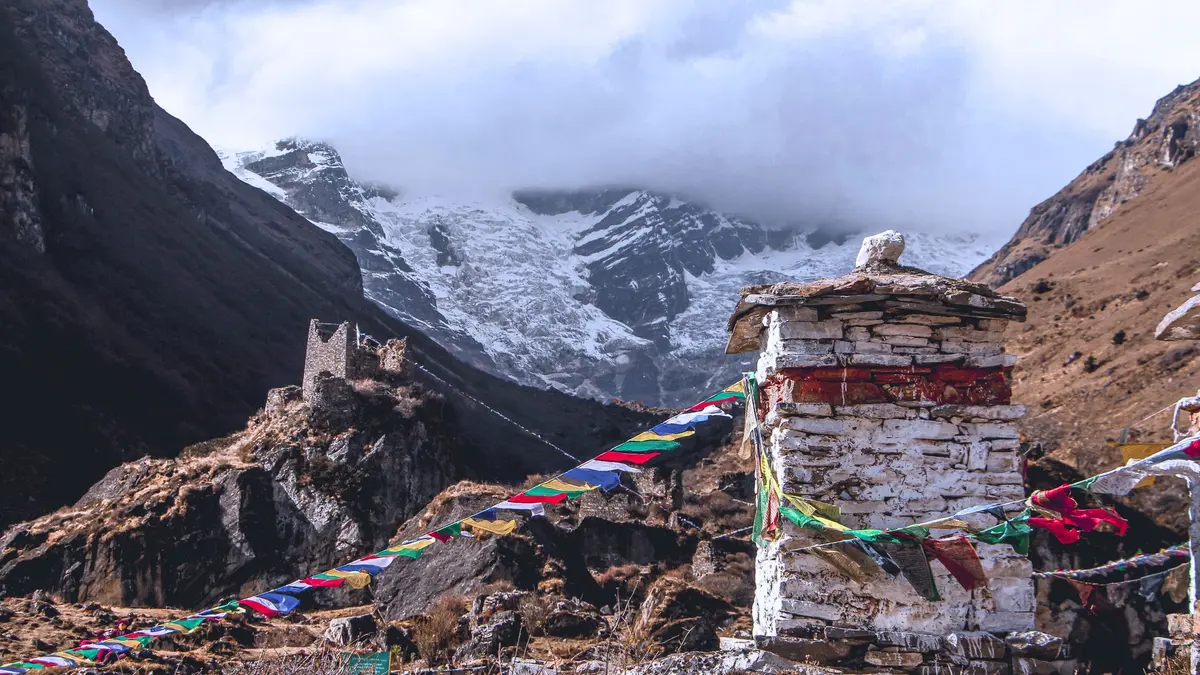
The Druk Path is the most accessible multi-day trek for first-time Bhutanese trekkers. It connects Paro to Thimphu across a series of high-altitude lakes — most famously Jimilang Tsho and Simkota Tsho — through forests of blue pine, rhododendron, and juniper.
The trail averages around 4,000m for most of its duration, which means consistent views of the Himalayan range from the ridgeline, but also means acclimatisation matters. Most itineraries spend the first two nights below 3,500m before pushing to the high terrain.
The alpine lakes are the signature attraction — semi-frozen in early spring, gin-clear and wind-rippled in autumn, reflecting the peaks above them in conditions of perfect stillness. The fishing in these lakes is reportedly excellent (brown trout, though check current regulations).
Why choose Druk Path over Jomolhari:
- Shorter (5–6 days vs 8–12)
- Lower maximum altitude (4,235m vs 4,890m)
- Ends in Thimphu, convenient for city touring afterward
- Less expensive due to shorter duration
Best season: October–November, April–May.
View Druk Path route map & elevation profile →
3. Laya-Gasa Trek — Yaks, Hot Springs, and Remote Villages
Duration: 12–15 days | Max Altitude: 4,890m (Nyile La) | Difficulty: Strenuous | Start: Paro, End: Punakha
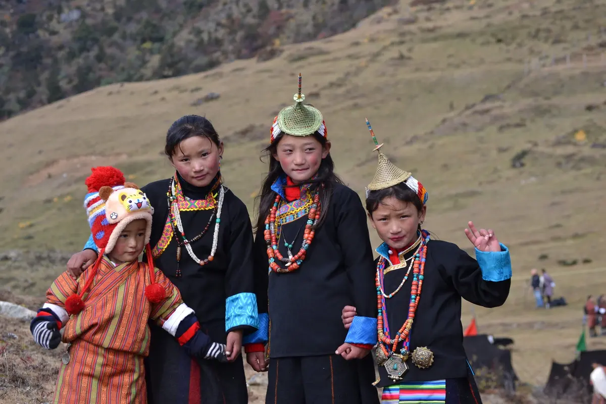
The Laya-Gasa Trek extends the Jomolhari route northward into increasingly remote terrain, eventually reaching Laya — one of Bhutan's most isolated communities, home to the distinctive Layap people, known for their tall conical bamboo hats and semi-nomadic yak-herding lifestyle.
From Laya, the route descends through Gasa to the Punakha valley, with the option to stop at Gasa's famous hot spring (Gasa Tshachu) — a natural thermal pool at around 2,700m that has been used for centuries for its purported medicinal properties. After days above 4,000m, soaking in the Gasa hot spring is genuinely one of the great trekking rewards anywhere.
The Laya-Gasa is the standard precursor to the Snowman Trek. If you plan to attempt the Snowman, completing Laya-Gasa first in a prior season is strongly advised for acclimatisation experience.
Best season: October–early November. The route is feasible in April–May with caution at the high passes.
4. Snowman Trek — One of the World's Great Wilderness Expeditions
Duration: 24–30 days | Max Altitude: ~5,320m | Difficulty: Extreme | Route: Paro to Bumthang (or reverse)
The Snowman Trek has a reputation that precedes it: frequently cited as one of the most difficult treks in the world, with a completion rate estimated at around 50 percent due to weather, terrain, and altitude. It traverses the Lunana district — the most remote region in one of the world's most remote countries — crossing 11 passes above 4,500m in sequence.
The Lunana district has fewer than 3,000 permanent inhabitants spread across a handful of high-altitude villages (Woche, Lhedi, Thanza, Tso Chena). The nearest road is a multi-day walk away. The nearest hospital is further. The Gangkhar Puensum massif — home to what is arguably the world's highest unclimbed peak at 7,570m — dominates the skyline for much of the route.
Why do people do it? Because the Lunana wilderness is extraordinary in a way that is almost impossible to articulate to someone who hasn't walked through remote high-altitude terrain. The scale of the landscape, the near-complete absence of any trace of the modern world, the physical and psychological challenge of sustaining effort for nearly a month — it produces an experience unlike anything available elsewhere.
Prerequisites for the Snowman:
- Prior high-altitude trekking experience (minimum: a route crossing a 4,500m pass)
- Excellent cardiovascular fitness (ability to run 10km in under 60 minutes is a common benchmark)
- Cold-weather camping experience
- Flexibility: weather delays of multiple days are normal
- Travel insurance with helicopter evacuation to Paro included
Best season: Mid-September to mid-October. The weather window is narrow — earlier carries monsoon tail risk, later carries early winter snowfall risk on the high passes.
Budget note: The Snowman is expensive. 25 days at the SDF rate plus operator fees typically runs USD 8,000–12,000 per person. However, per-day costs drop significantly in groups, and some operators offer the route at competitive rates in October shoulder weeks.
View Snowman Trek route map & elevation profile →
5. Trans Bhutan Trail — The Country, End to End
Duration: 35–45 days (full route) | Max Altitude: Variable, ~4,300m | Difficulty: Strenuous to Extreme | Route: Haa to Trashigang (west to east)
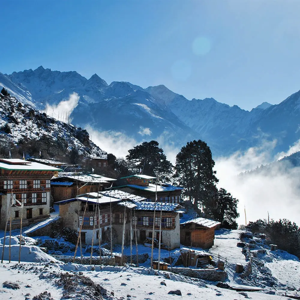
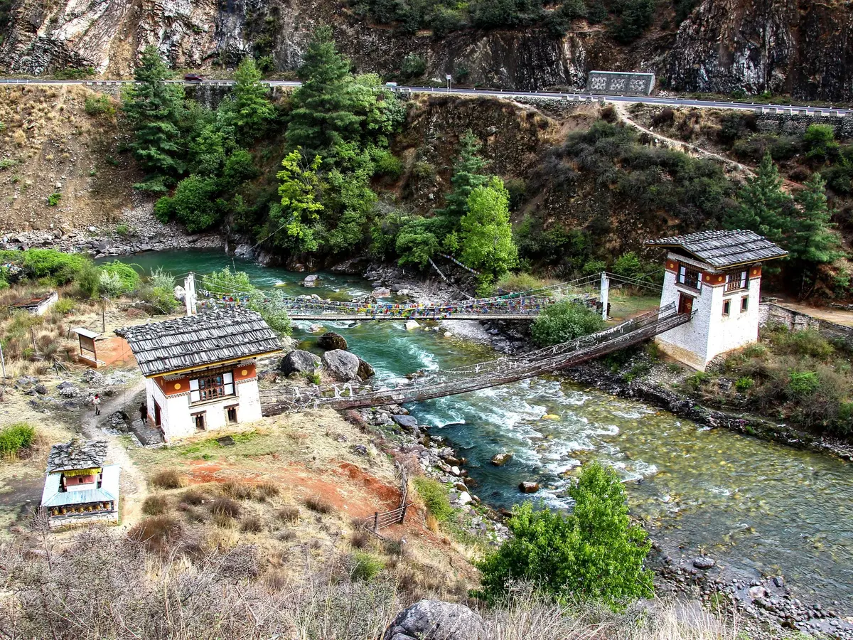
The Trans Bhutan Trail is a 403km route restored between 2020 and 2022 following the historic trade and pilgrimage path that once connected all of Bhutan's major dzongs. For centuries, this route was how the country moved — messengers, armies, monks, traders, and royal processions all walked it.
The modern restoration makes it the longest continuous trekking route in Bhutan and one of the most culturally rich long-distance walks in Asia. The full route passes through 14 districts, 400 villages, and alongside 400 years of Bhutanese history — encountering dzongs, lhakhangs, covered bridges, and communities that receive almost no tourist visitors.
The full Trans Bhutan Trail is one of the most ambitious walks available anywhere. Most trekkers, realistically, select a specific section rather than attempting the full route. The western sections (Haa to Thimphu, 6–8 days) are most popular for their mountain views. The central sections (Thimphu to Bumthang, 10–12 days) offer the deepest cultural immersion.
Best season: October–November, March–April. The full route is impractical during monsoon.
Explore the Trans Bhutan Trail →
6. Merak-Sakteng Trek — The Remote East
Duration: 6–8 days | Max Altitude: ~3,500m | Difficulty: Moderate to Challenging | Location: Trashigang district
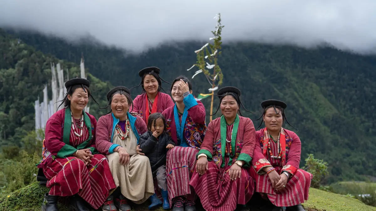
The Merak-Sakteng trek explores the far eastern Bumdeling Wildlife Sanctuary — home to the semi-nomadic Brokpa people, yaks, and the legendary Migoi (Bhutan's yeti). The Brokpa maintain a lifestyle largely unchanged from centuries past, herding yaks across high pastures and wearing distinctive yak-hair coats and cone-shaped felt hats.
This is one of Bhutan's more remote trekking experiences, requiring a flight or long drive to Trashigang before the trek begins. That distance is a significant advantage: fewer tourists reach this region, trail infrastructure is minimal, and the cultural encounters feel genuinely unscripted.
The Bumdeling Wildlife Sanctuary is also prime habitat for red pandas, Himalayan black bears, and a remarkable diversity of Himalayan birds.
Best season: October–November, March–May. Monsoon makes eastern Bhutan significantly wetter than the western valleys.
7. Dagala Thousand Lakes Trek
Duration: 5–6 days | Max Altitude: ~4,520m | Difficulty: Challenging | Start/End: Thimphu
South of Thimphu, the Dagala range shelters a network of alpine lakes (the "thousand lakes" of its name) at altitudes between 4,000m and 4,500m. The trek offers panoramic views of major Himalayan peaks — including Mount Everest, Gangkar Puensum, and Jomolhari — on clear days, along with excellent brown trout fishing and camping in pristine glacial terrain.
The route is accessible from Thimphu and provides high-altitude trekking experience without the longer commitment of the Jomolhari or Laya routes. It's a particularly good option for trekkers with limited time who want genuine high-altitude experience.
Best season: October–November. The lakes are partially frozen from December through March.
8. Royal Heritage Trek — Bumthang's Ancient Royal Route
Duration: 4–5 days | Max Altitude: ~3,800m | Difficulty: Moderate | Location: Bumthang district
Named after the route taken by Bhutan's second king between his royal palaces at Wangdichoeling and Kuenga Rabten, the Royal Heritage Trek is one of Bhutan's most historically layered walks. The route passes through Jakar Dzong — the fortress of the white bird, seat of the Bumthang penlop for centuries — and across the Kikila Pass into Trongsa.
Bumthang is Bhutan's spiritual heartland, with the highest concentration of ancient lhakhangs and temples in the country. The trek incorporates visits to Jambay Lhakhang (7th century), Kurje Lhakhang (containing the body print of Guru Rinpoche), and Tamshing Lhakhang (founded by the terton Pema Lingpa in 1501).
Best for: Trekkers with a strong interest in Bhutanese history and Buddhist culture who prefer moderate rather than strenuous terrain.
Best season: All seasons except monsoon peak (July–August). Bumthang is particularly beautiful in October (buckwheat harvests) and spring (apple orchards in bloom).
9. Gangkar Puensum Base Camp Trek
Duration: 18–22 days | Max Altitude: ~5,200m | Difficulty: Extreme | Start: Bumthang
Gangkar Puensum (7,570m) is the world's highest unclimbed peak. Bhutan has prohibited all mountaineering above 6,000m since 1994 on the grounds that high peaks are sacred, so the summit will remain unclimbed for the foreseeable future. What is accessible is a base camp trek into the glacier approaches — a genuinely remote expedition through the Chamkhar Chhu river system.
This route is not for casual trekkers. It requires an experienced expedition company, full logistics support, and serious high-altitude preparation. It is, however, one of the most extraordinary wilderness walks in the Himalayan range — a journey into terrain that almost no foreign visitors have seen.
Best season: October only. The approach valleys are deeply affected by monsoon rainfall and the route becomes dangerous outside the autumn window.
The Best Day Hikes and Short Treks
Not every Bhutanese trek requires a week in the mountains. These shorter routes deliver dramatic scenery and cultural depth within a half-day to two-day timeframe.
Taktsang (Tiger's Nest) — 5km, 4–6 hours, Challenging
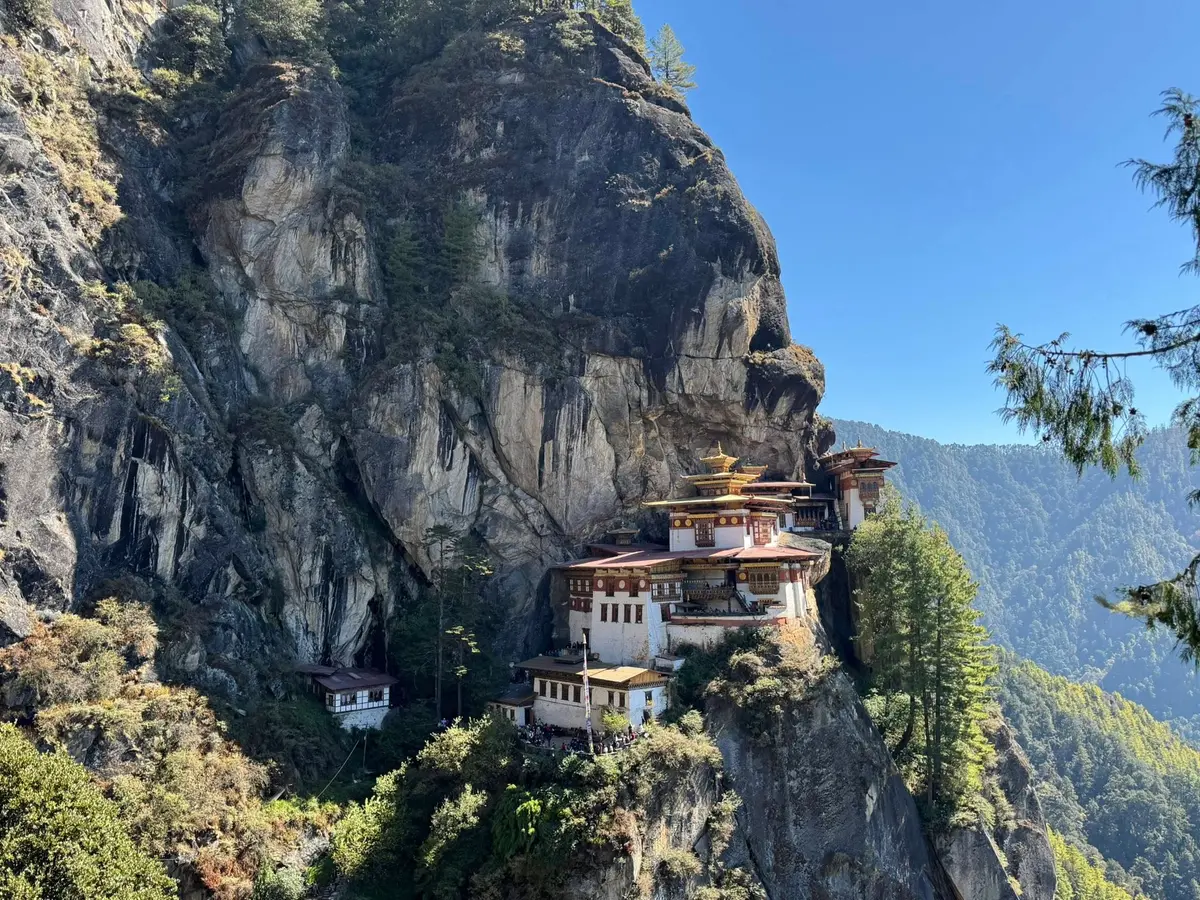
The most famous hike in Bhutan. The Tiger's Nest Monastery (Taktsang Palphug) clings to a 3,000m cliff face above the Paro valley, accessible only by a steep trail that gains 900 vertical metres from the valley floor. The monastery is one of the most sacred pilgrimage sites in the Buddhist world. Full details in our dedicated Tiger's Nest hiking guide.
Chelele Trek — 16km, Full Day, Moderate to Challenging
Beginning from Chelela Pass (3,988m) — the highest motorable pass in Bhutan — the Chelele nature trek ascends further to a high viewpoint at approximately 4,250m, offering what is arguably the most accessible 360-degree Himalayan panorama in the country. On clear days, Jomolhari, Jichu Drake, and the eastern peaks of Bhutan are visible simultaneously. The lower trail descends through rhododendron forest into the Haa valley.
Phajoding — 9km, 3–4 hours return, Moderate
One of Thimphu's most rewarding hikes, ascending through blue pine forest above the suburb of Motithang to the monastic complex of Phajoding (3,630m). The trail is well-defined and busy by Bhutanese standards, though it remains quiet by any international comparison. Views of Thimphu city and the valley are best in early morning.
Wangditse — 8km, 2.5 hours, Easy to Moderate
A gentler alternative to Phajoding, ascending to the Wangditse Monastery (2,685m) through pine and oak forest. Best known for its bird's-eye view of Tashichho Dzong directly below. Ideal for a morning hike before an afternoon of Thimphu city exploration.
Tango Monastery — 3km, 1.5 hours, Moderate
The short but steep trail from Dodeyna to Tango Monastery (2,600m) leads to one of Bhutan's most important monastic universities, founded in the 12th century. The monastery is a working academic institution — you'll encounter students in maroon robes studying the ancient texts alongside tourists.
Lungchutse — 3.5km, 2 hours, Moderate
Above Tango, a further ascent reaches Lungchutse Monastery (3,800m) — one of Thimphu's most popular hikes for both locals and visitors. The ridgeline offers extensive views of the Bhutanese Himalaya to the north.
Nub Tshonapata — 35km, 4–5 days, Challenging
A less-explored route through rhododendron and juniper forest leading to the turquoise Nub Tshonapata Lake at 4,350m. This trek is unique in Bhutan for its combination of forest, high-altitude lake, and near-complete isolation — few tour operators run it regularly. Suitable for trekkers looking specifically for routes off the beaten Bhutanese path.
Sinchula — 26km, 3 days, Moderate
The Sinchula ridge route in western Bhutan winds through a succession of blue pine, rhododendron, and oak forests, passing terraced rice fields and remote villages. It is specifically recommended for winter trekking — the trail stays at moderate elevation, clear of snow, while offering mountain views to the north. Ideal from December through February when higher routes are closed.
Budget Breakdown: What Trekking in Bhutan Actually Costs
The SDF structure means costs are more predictable in Bhutan than in Nepal or Tibet. Here is a realistic breakdown:
Multi-Day Trek Budget (Per Person)
| Item | Cost |
|---|---|
| Bhutan visa | USD 40 (one-time) |
| SDF | USD 100 per night |
| Operator package (guide, crew, camping, meals) | USD 80–150 per night |
| International flights (rough estimate, varies hugely by origin) | USD 500–2,000 |
| Personal gear (if purchasing new) | USD 200–600 |
| Personal expenses (drinks, souvenirs, tips) | USD 30–80 per day |
| Total (10-day trek, single traveller) | USD 2,500–4,500 |
Cost-Reduction Strategies
Travel in a group. Most operators reduce per-person costs significantly for groups of four or more, as guide, horseman, and cook costs are shared. A solo trekker pays full crew costs alone; a group of six splits them six ways.
Choose shoulder season. October is peak season in Bhutan and operators price accordingly. The same trek in late November or early April often costs 10–20 percent less with no meaningful reduction in experience quality.
Select shorter routes. Ten days of SDF costs USD 1,000. Five days costs USD 500. Combining a 5-day Druk Path Trek with a few days of Paro/Thimphu cultural exploration delivers a full Bhutan experience at a significantly lower total than a 12-day Jomolhari.
Budget trekking packages — specifically marketed as such — are available from some operators for USD 70–90 per night in addition to the SDF. These use standard camping equipment rather than luxury gear and smaller crews. The trail and scenery are identical.
Tipping Guide
Tipping trek crews is expected and genuinely important — it constitutes a significant portion of local income.
| Role | Suggested Tip (per day, per group) |
|---|---|
| Trek guide | USD 15–20 |
| Cook | USD 10–15 |
| Horseman/pack handler (per horse) | USD 8–12 |
| Helper | USD 8–10 |
For a 10-day trek with a standard 5-person crew, budget USD 600–900 total for tips across the group. This is not optional in any meaningful ethical sense.
What to Pack: Complete Trekking Gear List
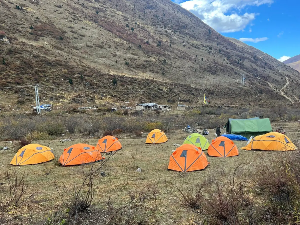
Your tour operator provides camping equipment (tent, sleeping bag rated to -10°C, mattress, dining tent). You provide everything else. All of it must fit in one pack you can carry yourself — pack light.
Clothing (Layering System)
- Moisture-wicking base layer (top and bottom) — 2 sets
- Insulating mid-layer (fleece or down jacket)
- Waterproof hardshell jacket (essential — even in October)
- Waterproof trousers
- Trekking trousers — 2 pairs
- Warm hat (wool or fleece)
- Sun hat with brim (UV intensity at 4,000m is severe)
- Gloves — thin liner pair + warm outer pair
- Warm socks (merino wool preferred) — at least 4 pairs
- Gaiters (useful in wet and snowy conditions)
Footwear
- Trekking boots: full ankle support, waterproof membrane, broken in before arrival. This is non-negotiable. New boots on the Jomolhari will end your trek early.
- Camp shoes or sandals (for evenings at camp)
Gear
- Trekking poles — 2 (collapsiblre, strongly recommended)
- Daypack 25–35 litres (your operator's horses carry the main load)
- Sleeping bag liner (adds warmth, keeps bag clean)
- Headlamp with spare batteries
- Water bottles (minimum 2 litres capacity) or hydration bladder
- Water purification tablets or filter (as backup — operators provide purified water)
- Sunscreen SPF 50+ (high altitude UV burns fast)
- Lip balm with SPF
- Sunglasses with UV protection (glacier glasses if on high snow routes)
Health & Safety
- Personal first aid kit (blister treatment is most critical)
- Diamox (acetazolamide) for altitude sickness prevention — consult your doctor before travel; obtain a prescription in your home country
- Ibuprofen, electrolyte sachets
- Rehydration salts
- Any personal medications with extra supply
- Moleskin or second-skin blister patches
Electronics
- Camera with spare batteries (cold depletes lithium batteries rapidly at altitude)
- Power bank (trekking camps have no mains power on most routes)
- Universal adapter (for charging in Paro/Thimphu hotels)
- Satellite communicator or GPS if on remote routes (your operator handles emergency comms but personal backup is prudent)
Acclimatisation: The Most Important Thing No One Tells You
The most common reason treks get cut short in Bhutan is altitude sickness — not bad weather, not injury, but people ascending too fast and ignoring the warning signs.
Basic Acclimatisation Rules
The cardinal rule: Never ascend more than 300–500 metres per day above 3,000m. If your itinerary has you crossing from 2,700m to 4,200m in a single day (it happens on some routes), build a rest day before that push.
Rest days are climbing days. A rest day at Jangothang (4,090m) — the standard acclimatisation camp on the Jomolhari — is not a lost day. It's the day that makes the rest of the trek possible.
Know the symptoms:
- Mild AMS (Acute Mountain Sickness): headache, fatigue, loss of appetite, slight dizziness. Rest, hydrate, do not ascend.
- Moderate to severe AMS: intense headache not relieved by ibuprofen, vomiting, confusion, loss of coordination. Descend immediately, do not sleep at that altitude.
- HAPE (High Altitude Pulmonary Edema) and HACE (High Altitude Cerebral Edema) are medical emergencies requiring immediate helicopter evacuation.
Diamox (acetazolamide 125mg twice daily, starting 24 hours before major ascent) significantly reduces AMS risk for most people. Side effects are minor (increased urination, mild tingling in extremities). Discuss with a physician before travel.
Hydrate more than you think you need to. At altitude, respiratory water loss increases substantially. Aim for 3–4 litres per day on high routes.
Booking Your Trek: How to Choose an Operator
All licensed Bhutanese tour operators are registered with the Tourism Council of Bhutan (TCB). You can search the official TCB directory at tourism.gov.bt. For trekking specifically, look for operators with:
- Dedicated trekking department with full camping equipment
- Licensed and trained guides with specific high-altitude certification
- Clear emergency protocols including satellite phone or communication device on multi-day high routes
- References or reviews from previous trekking clients on the specific routes you want
Questions to ask when comparing operators:
- What camping equipment is included? What is the sleeping bag temperature rating?
- How many clients has your team led on this specific route in the past two seasons?
- What is your emergency protocol if a client shows signs of altitude sickness on day 5 of the Jomolhari?
- Who is the guide? Can I review their qualifications?
- What is included vs. not included in the quoted price?
A good operator answers these without hesitation. An operator who becomes evasive on equipment or emergency protocols is a concern.
Frequently Asked Questions
Do I need prior trekking experience for the Druk Path Trek?
The Druk Path reaches 4,210m and involves 5–6 days of sustained mountain walking. Prior multi-day hiking experience (not necessarily at altitude) is beneficial. Physical fitness matters more than specific experience — if you can comfortably hike for 6–7 hours with a daypack, you can manage the Druk Path with proper pacing and acclimatisation.
Can I trek independently without a guide?
No. All overnight trekking in Bhutan requires a licensed guide through a registered operator. This is national policy and is non-negotiable. Day hikes that begin and end in the same town (such as the Tiger's Nest hike or the Wangditse walk from Thimphu) can technically be done without a guide, though a guide adds significant value.
How physically demanding is the Jomolhari Trek compared to, say, the Annapurna Circuit?
The Jomolhari is shorter than the full Annapurna Circuit but reaches comparable altitudes (Thorong La Pass is 5,416m vs Jomolhari's 4,890m Nyile La). The key difference is trail infrastructure — the Annapurna Circuit has tea houses every few hours, whereas the Jomolhari requires full camping support but provides near-total solitude. Physically, they require similar preparation.
Is the Snowman Trek appropriate for a first Bhutan visit?
No. The Snowman requires specific high-altitude experience, extended expedition logistics, and a narrow weather window. A first Bhutan visit should be something like the Druk Path or Jomolhari 1. After completing those, the Snowman becomes a meaningful second or third-trip objective.
What happens if the weather closes a high pass during my trek?
Weather decisions are made by your guide in consultation with the operator. If a pass is unsafe (fresh snow, high wind, cloud), the itinerary is modified — an alternative route, an extra rest day, or in some cases an early descent to lower altitude. This is one of the reasons experienced, local guides matter so much: they know when a pass will clear and when it won't.
Can I trek during Bhutan's major festival season?
Yes, and it can be spectacular — many treks pass through or near villages where festivals are celebrated. However, October coincides with both peak trekking season and peak festival season (Thimphu Tshechu, Wangdue Tshechu), which means limited accommodation availability in Thimphu and Paro. Book your operator at least 4–6 months in advance for October visits.
What is the altitude sickness risk on the Druk Path?
The Druk Path spends 3–4 days above 3,800m, with camps at Jimilang Tsho (4,020m) and near the Phume La (4,210m). Altitude sickness is a real possibility and a rest/acclimatisation night in Thimphu (2,320m) before starting is strongly recommended. Mild headaches are common; with proper hydration, pacing, and optional Diamox use, most fit trekkers complete the route without serious difficulty.
Are trekking permits separate from the tourist visa?
Your tourist visa covers entry to Bhutan. Trekking permits for protected areas are separate documents but are arranged by your tour operator as part of the package. You do not handle this paperwork directly. Confirm with your operator that all necessary permits are included in your quoted price.
How much should I budget for a first trekking trip to Bhutan?
For a 7-day trip including 5 days of trekking (e.g., the Druk Path), budget approximately USD 2,000–3,000 per person including the SDF, operator fees, visa, and domestic transfers — before international flights. Groups significantly reduce per-person costs.
Planning Your Trek: Recommended Itineraries
8 Days — First-Timer Trek (Druk Path + Paro)
- Day 1: Arrive Paro, acclimatise (2,280m)
- Day 2: Paro valley exploration — Tiger's Nest hike
- Day 3: Transfer to trek start, ascend to Jele Dzong (3,480m)
- Day 4: Jele Dzong to Jimilang Tsho (4,020m) — first high camp
- Day 5: Jimilang Tsho to Simkota Tsho (4,090m)
- Day 6: Simkota to Phajoding camp (3,630m)
- Day 7: Descend to Thimphu, afternoon city tour
- Day 8: Depart
14 Days — Classic Jomolhari Experience
- Day 1–2: Arrive Paro, acclimatise, sightseeing
- Day 3: Trek start — Paro to Soe Thangthangka (2,950m)
- Day 4: Soe Thangthangka to Jangothang base camp (4,090m)
- Day 5–6: Jangothang rest days — side hike, mountain views
- Day 7: Jangothang to Lingshi over Nyile La (4,890m)
- Day 8: Lingshi dzong exploration
- Day 9–10: Descent through Naro to Shana
- Day 11: Final descent to Thimphu road, transfer
- Day 12: Thimphu sightseeing
- Day 13: Transfer to Paro, Rinpung Dzong visit
- Day 14: Depart Paro
Bhutan's trails are not just routes from A to B. They are archives — physical repositories of Himalayan history, Buddhist culture, and ecological complexity. Every pass crossed was crossed by generations of traders and pilgrims before you. Every chorten at the trail junction was placed there intentionally, at the confluence of energies that some Bhutanese can explain in detail and others simply feel.
That depth doesn't require climbing to 5,000m to access. It's on the half-day walk to Tango Monastery above Thimphu. It's on the rice field trails of the Tsento Gewog. It's on the forest path to Phajoding, where the pine gives way to ridgeline and the Himalayan horizon expands in every direction.
Whatever your fitness level, whatever your timeline, there is a Bhutanese trail that fits. The question is not whether to walk — it's which walk to take first.