Bhutan's Himalayan Geography: From Nehru on Horseback to Gelephu Mindfulness City
By Best of Bhutan Editorial Team · March 24, 2026 · 20 min read
There is something quietly astonishing about reading an old geography textbook. Its prose is dry, its maps are dated, its statistics have long since been overtaken by events. And yet every so often, if the country it describes is the right country, you find that the book has not aged so much as it has become prophetic. Geography of the Himalaya by S.C. Bose is one such book. Written sometime in the 1970s, it contains a chapter on Bhutan that reads, in retrospect, less like a regional survey and more like a baseline against which one of the most remarkable national arcs of the twentieth and twenty-first centuries can be measured.
The chapter is short — barely eight pages of the book's 241. Bhutan gets no more real estate than the Assam Himalaya or the Darjeeling hill stations that precede it. And yet those eight pages contain, compressed into the matter-of-fact language of academic geography, a portrait of a kingdom so isolated, so physically hemmed in, and so entirely dependent on a single large neighbor that its subsequent trajectory seems almost implausible. That Bhutan would become, within fifty years, the only country in the world to measure national success in units of happiness — and that it would announce, in 2023, a city designed from scratch on principles of mindfulness, sustainability, and spiritual economy — is not something that any geographer in the 1970s would have predicted. And yet the seeds of all of it are visible, if you know where to look, even in Bose's pedestrian paragraphs.
This essay is an attempt to read that book the way a geologist reads a rock formation: slowly, looking for the forces beneath the surface, tracing the deep structures that made what came later not just possible but perhaps inevitable.
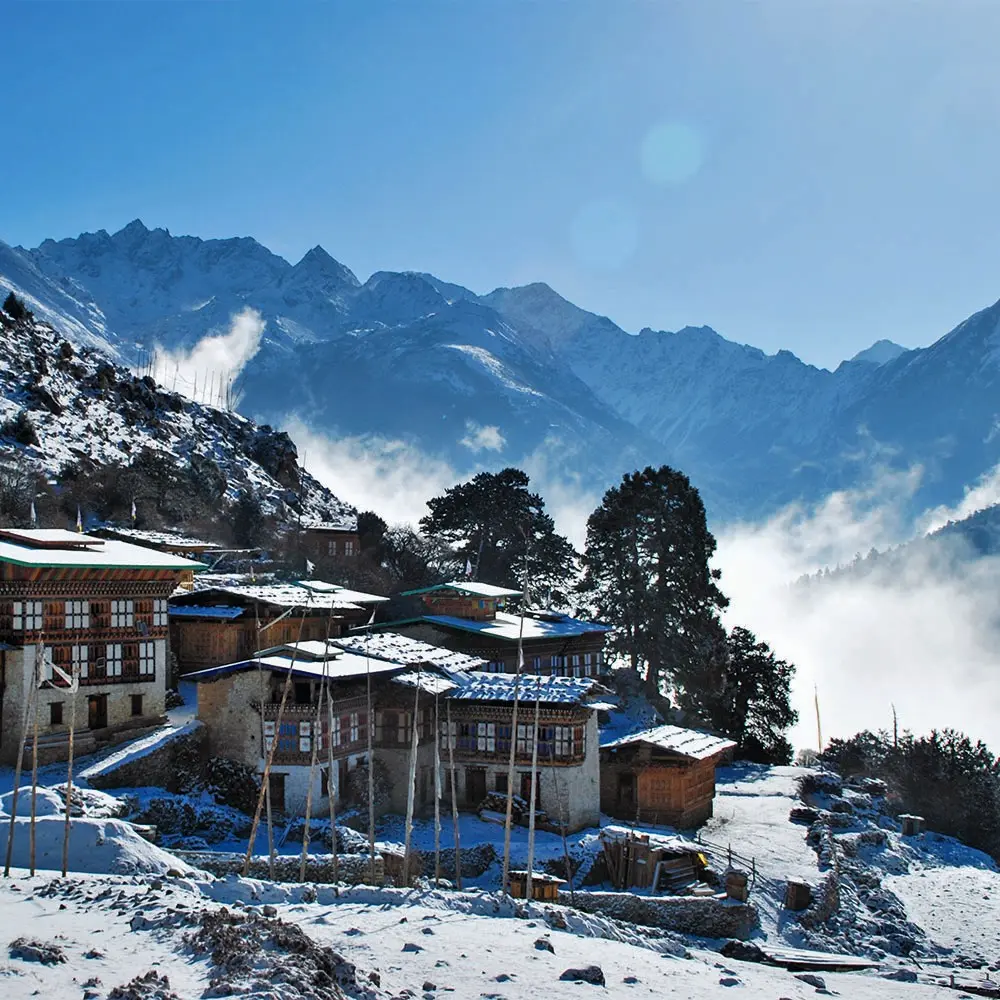
The Great Arc of Snowy Ranges
Begin with the land itself, because in Bhutan's case, geography is not merely context — it is character. Bose describes the Bhutan Himalaya as "a great arc of snowy ranges in the north from which descend snow-fed rivers," a phrase so precise and so evocative that it deserves to be read slowly. The arc runs from Chomo Lhari in the west — at 7,314 meters, a peak so sacred that it has never been climbed with local permission and few have climbed it at all — to Kulha Kangri at 7,541 meters in the center, and continues eastward through ranges that have no single name and in some places no reliable survey.
Geographic Note
Bhutan spans approximately 300 km east to west and 150 km north to south. Its elevation ranges from around 200 m in the subtropical south to over 7,500 m in the north — one of the steepest altitudinal gradients of any nation on earth.
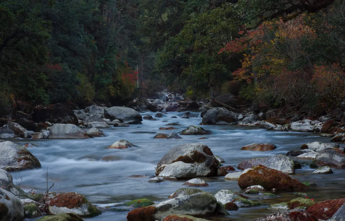
What this arc creates, physically, is a country organized entirely by water. Bhutan is a nation of rivers, and every river in it originates in glaciers and snowfields above 5,000 meters and flows — often violently, always dramatically — southward through terrain that compresses in a few dozen kilometers what would elsewhere require a thousand. The rivers descend through "glacial features such as amphitheatres, truncated spurs, waterfalls and U-shaped valleys," Bose writes, and then, "passing farther south the rivers have dug fantastic gorges through the ranges before going out to the plains."
The word "fantastic" is not rhetorical. The gorges of western Bhutan, where rivers like the Wong Chhu drop thousands of meters over short horizontal distances, are among the most dramatic in Asia.
Between the snowy north and the gorged south, the rivers have carved a series of small basins. These are the human habitats of Bhutan: flattish valley floors at elevations between 1,500 and 2,500 meters, surrounded on all sides by rock walls that rise abruptly to four, five, and six thousand meters. Paro sits in one of these basins. Thimpu, the current capital, occupies another. Punakha, the old winter capital, lies in a third. Bose notes, with a geographer's characteristic understated speculation, that these basins "were perhaps lake bottoms in the past" — naturally impounded lakes that gradually drained as rivers cut through the surrounding ridges. Whether or not that is exactly right, the effect is unmistakable: the valleys of Bhutan feel enclosed, cradled, as if the mountains gathered around them deliberately.
This geography has consequences. It means that every major Bhutanese settlement has historically been reachable from its neighbors only by crossing high passes or descending and re-ascending steep river gorges. It means that east and west Bhutan were, for most of history, more isolated from each other than either was from distant places across the mountains. It means that the country had, in effect, no natural transportation corridors — no broad valley running lengthwise, no navigable river, no piedmont highway. It was a country designed, by terrain, for insularity.
| Elevation | Key Geographic Feature | Significance |
|---|---|---|
| 7,541m | Kulha Kangri | Highest Peak |
| 7,314m | Chomo Lhari | Sacred Peak |
| 2,500m | Thimpu Basin | Capital Altitude |
| ~200m | Southern Plains | Gelephu Elevation |
The Rivers and What They Carry
To understand Bhutan's geography in any depth is to become a student of its rivers. Bose catalogs them with the systematic patience of a surveyor: the Amo Chhu in the far west, whose upper portion lies in Tibet's Chumbi Valley before entering India as the Torsa; the twin rivers Paro Chhu and Wong Chhu, which join at "the confluence" and run southward as the Raidak; the Mo Chhu, flowing past the small basin of Punakha; and in the east, the various tributaries that join together to form the Manas in Assam. Each river is more than hydrology. Each is a corridor of culture, a route of access, a source of subsistence, and — as Bose correctly intuited, and as history would spectacularly confirm — a source of enormous latent power.
| Bhutanese Name | Name in India | Valley / Settlement | Notes |
|---|---|---|---|
| Amo Chhu | Torsa | Far western corridor | Originates in Tibet's Chumbi Valley; "very turbulent" per Bose |
| Paro Chhu + Wong Chhu | Raidak | Paro, Thimpu basins | Join at "the confluence"; capital region |
| Mo Chhu | Sankosh | Punakha basin | Old winter capital; dramatic confluence with Pho Chhu |
| Mangde Chhu | Beki | Trongsa / central Bhutan | Trongsa Dzong straddles the gorge |
| Manas / Drangme Chhu | Manas | Eastern river system | Multiple eastern tributaries; Manas Tiger Reserve downstream |
What is most striking about Bose's treatment of the rivers is his passing observation — offered without particular emphasis, as if it were simply a footnote — that Bhutan's rivers represent "an immense potential of power" and that "when developed, this power may even be sold to India." This sentence, tucked into a paragraph about small hydro-electric stations producing four megawatts each at Paro and Thimpu, turned out to be one of the most consequential geographic predictions in the region's modern history.
Hydropower would become the engine of Bhutan's economy. Today, Bhutan exports more than 1,400 megawatts of electricity to India — a number that makes the four megawatts of the 1970s seem almost touching in its modesty. The Chhukha hydropower project, which Bose mentions as being under construction at 200 megawatts, was followed by Tala at 1,020 megawatts, Punatsangchhu I and II, Dagachhu, Mangdechhu, and many more. The rivers that Bose catalogued as geological features are, in the twenty-first century, the financial backbone of a kingdom that has transformed from one of the poorest to one of the most ambitious nations in the world.
"Bhutan's rivers represent an immense potential of power. When developed, this power may even be sold to India."
— S.C. Bose, Geography of the Himalaya, c. 1970s
The Cartography of Isolation
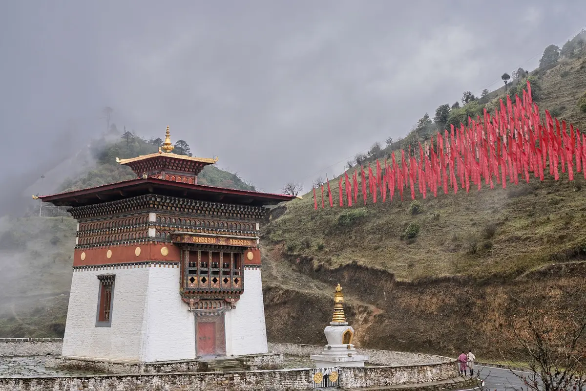
One detail in Bose's Bhutan chapter stops every reader in their tracks, regardless of how many times they have encountered it. It is this: when Prime Minister Jawaharlal Nehru wished to visit Bhutan in the 1950s, he was obliged to travel by horseback. Not because no other means existed in principle, but because no road existed into Bhutan at all. Nehru's route took him through Nathu La, the high mountain pass in Sikkim at 4,310 meters, then into Tibet's Chumbi Valley — a detour into a foreign country — and finally down to Ha Dzong and Paro in Bhutan. He was the leader of the world's largest democracy, visiting a neighboring kingdom on a diplomatic mission of the highest order, and the only way to get there was on horseback through another nation's territory.
The image is extraordinary. It is not merely colorful geography trivia. It is a precise measurement of isolation. In the mid-twentieth century, Bhutan was not simply remote in the way that, say, a mountain village in Switzerland is remote — reachable by road if you are determined, merely inconvenient rather than inaccessible. Bhutan was structurally disconnected from the outside world. Its borders were, for practical purposes, the mountains themselves. The few passes that existed were seasonal, high, and treacherous. There was no wheeled traffic. There was essentially no postal system, no telegraph line, no radio network. The kingdom administered itself through a system of dzongs — fortress-monasteries that served simultaneously as administrative headquarters, temples, and grain stores — that were connected to each other by footpaths and mule tracks.
This isolation was not incidental. To some extent, it was deliberate. The Bhutanese state had maintained a policy of strict seclusion for centuries, partly for strategic reasons (the memory of Tibetan and later British pressure on its sovereignty was not forgotten), partly for cultural ones (the Buddhist establishment that co-governed the kingdom had reasons to prefer limited outside contact), and partly simply because the terrain made it easy. You do not need a wall if you have the Himalayas.
The Indo-Bhutan Road and What It Changed
The moment that ended Bhutanese seclusion was not a revolution or a treaty or a war. It was a road. Bose describes it with bureaucratic precision: "The Government of India has built a good motor road from Phuntsoling on the border to Paro. A branch road from it, taking off at a point called 'the confluence', extends to Thimpu, the present capital and on to Punakha." This road, built in the early 1960s under the India-Bhutan development cooperation program, was in the fullest sense the beginning of Bhutan's modern history. Before it, everything that entered or left Bhutan — every tool, every piece of cloth, every bag of rice — traveled on the backs of animals or human porters. After it, trucks could carry cement and steel and machinery that made the construction of everything else possible.
What is remarkable, reading Bose's account from the contemporary vantage point, is how much of Bhutan's modern institutional infrastructure was built in those early decades with Indian assistance — and how thoroughly, over the following half-century, Bhutan would make that infrastructure its own and transcend it. The National Assembly and Secretariat of Thimpu were built to plans drawn up by the Indian Institute of Technology, Kharagpur. The power stations at Thimpu and Paro were built with Indian financial support. India supplied 25 megawatts of electricity free of charge from the Jaldhaka station in West Bengal while Bhutan's own capacity was being developed. The entire physical scaffolding of the modern Bhutanese state was erected, in its first phase, by Indian engineers, Indian funding, and Indian political goodwill.
Thimpu Rising: Planning a Capital from Scratch
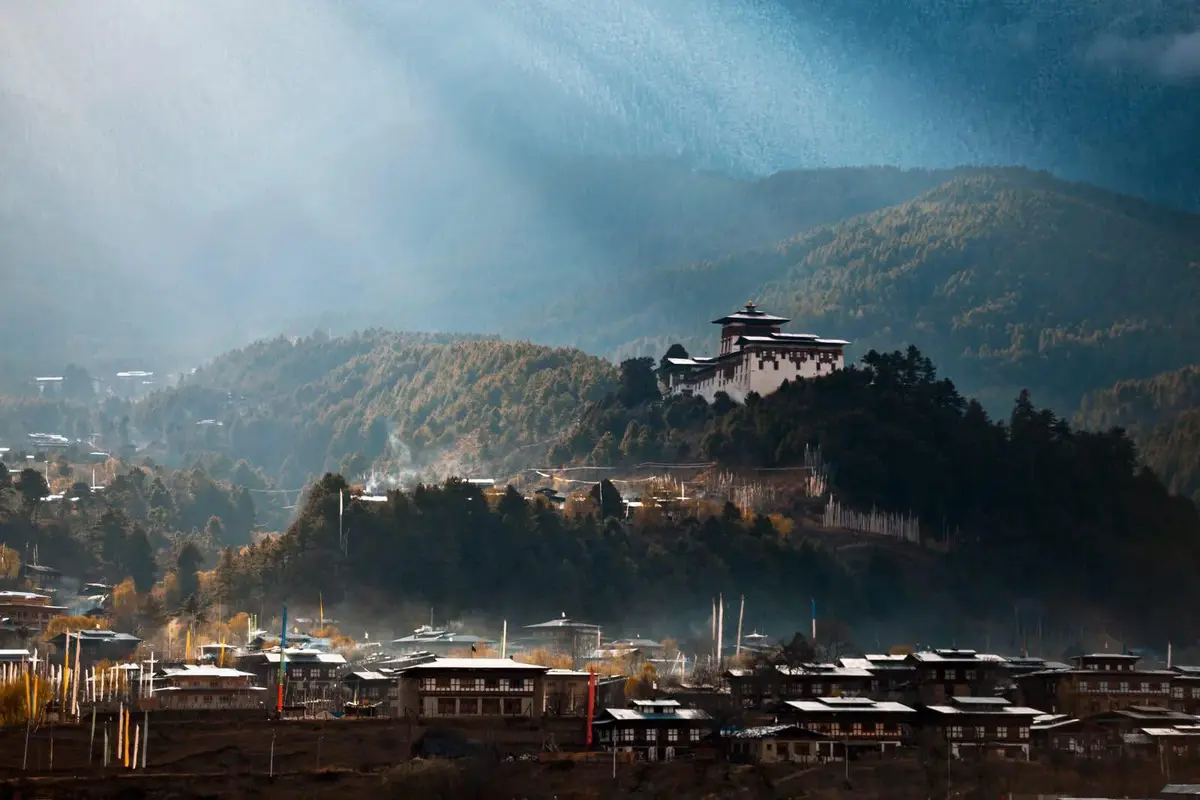
In Bose's account, Thimpu is described in terms that would be almost comic if they were not so earnest. "Earlier Thimpu consisted of only a few huts," he writes. "But today it is taking on a modern look." The plans for the capital — schools, hospitals, residential quarters, shopping and recreation centres — are presented as aspirational achievements, things that are "gradually coming up." The new capital, Bose notes, sits at 2,500 meters in a basin "surrounded by rock walls rising to 4,000 metres," about 30 kilometres south-west of the old capital of Punakha.
There is something conceptually interesting in the act of planning a new capital from scratch. Unlike most capital cities, which grow organically from older settlements, Thimpu was a deliberate project — a political decision made material in concrete and stone. The fact that its plans were drawn up in Kharagpur, at one of India's most prestigious technical institutes, means that the city's basic spatial logic was imported along with its technical specs. What was not imported — what was and remains entirely Bhutanese — is the aesthetic language in which that spatial logic was clothed. The traditional rammed-earth construction of the old dzong style was preserved and extended; the white walls and ornate woodwork that characterize Bhutanese architecture were mandated by law. Thimpu became, in this sense, a hybrid city: technically modern, culturally Bhutanese, and at every level a product of a careful negotiation between outside expertise and internal identity.
That negotiation would become the template for everything that followed. Bhutan's remarkable ability to accept foreign investment and expertise while maintaining cultural sovereignty — to modernize without being absorbed — has its roots in exactly this founding moment: the first town, planned by foreign engineers, built in traditional style, administered by a national government that knew exactly what it wanted to look like.
Eastern Bhutan: The Part Left Behind
If western Bhutan in the 1970s was the story of a kingdom cautiously opening its doors, eastern Bhutan was the story of doors still firmly closed. Bose is clear about this: "Eastern Bhutan is still very isolated and the valleys here are little known." The towns he names — Tongsa Dzong, Byakar Dzong, Tashi Gang — are described as "remote places" in valleys that "join together to form the Manas river in Assam." A lateral highway through them "to Wangdu Phodrang and Thimpu" is mentioned as a plan rather than a reality. A few new roads — the Samdrup Jongkhar–Tashi Gang Road, the Hathisan–Tongsa Road, the Sarbhang Road — are noted as having recently been built, but the east remains essentially off the map in any practical sense.
Eastern Bhutan Today
The Lateral Road — connecting Thimpu to Trashigang in the east — was eventually completed, spanning over 560 km. It remains one of the most spectacular mountain highways in Asia, regularly closed in winter. The east is still the least developed part of Bhutan.
This pattern of uneven development — west first, east later, south last — reflects the underlying geography. The western valleys were closest to the Indian border crossings, most accessible from the initial road, and historically the political core of the kingdom. The east was simply far away in a country where "far" is measured not in kilometers but in hours of mountain driving on a single-lane road. It remains, by most metrics, the least developed part of Bhutan to this day.
But it is not the east that is most geographically interesting in Bose's account. It is the south — specifically, the far southern lowland fringe that the book barely mentions. This narrow strip of subtropical plains at the base of the Himalayan foothills — a belt of land below 300 meters, hot, humid, malarial in the past — was historically the least valued and least administered part of Bhutan. The dzong system, the monastic institution, the cultural identity of the kingdom were all products of the middle-altitude valleys. The plains were, if anything, something to be kept at arm's length: a buffer zone, a source of timber, a place where Bhutanese administrative reach faded into ambiguity.
One of these southern lowland areas is a small town called Gelephu.
The Prophecy and Its Fulfillment
Near the end of his Bhutan section, Bose writes a sentence that, in retrospect, reads less like a geographic forecast and more like an epitaph for one chapter and a prologue for another. "Bhutan will in the near future be a modern hill state," he writes, "if progress continues at the present rate."
From the Text — S.C. Bose, c. 1970s
"Bhutan will in the near future be a modern hill state, if progress continues at the present rate."
Written when Thimpu "consisted of only a few huts." The remark, modest as it seems, proved not merely correct but a dramatic understatement.
The remark, modest as it seems, proved not merely correct but a dramatic understatement. The modesty of the prediction is itself instructive. Bose was not envisioning a kingdom that would become globally famous for inventing a new metric of national wellbeing. He was not imagining a country that would maintain 70% forest cover as a constitutional mandate, that would become carbon-negative, that would receive more international attention per capita than almost any other nation its size. He was simply suggesting, carefully, that roads and hospitals and power stations, sustained over time, might produce something that could be called modernity.
What actually happened was both more and less than modernity in the conventional sense. Bhutan modernized, certainly — it built roads and schools and hospitals and airports, and later the internet and mobile networks and a stock exchange. But it also did something no other developing country had done: it constructed a philosophical framework for development that explicitly rejected the equation of progress with economic growth. The concept of Gross National Happiness, introduced by the Fourth King in the 1970s — right around the time Bose was writing his geography — proposed that the development of a nation should be evaluated across four pillars: sustainable development, preservation of culture, conservation of environment, and good governance. GNH was not a feel-good slogan. It was a governing philosophy, institutionalized in the Constitution of 2008.
Gelephu: Where the Mountains Meet the Plains
The town of Gelephu sits at the point where the foothills of the eastern Himalayas finally give out and the flat alluvial plains of Assam begin. Its elevation is barely above 200 meters — a dramatic drop from the 2,500 meters of Thimpu, reached by a road that descends in great switchbacks through subtropical forest. For most of Bhutanese history, Gelephu was a border crossing and not much more: a place where goods from India entered the country and timber from Bhutan's forests left it. It appeared in no significant planning document. It had no symbolic weight. It was, in geographic terms, a threshold rather than a destination.
In late 2023, His Majesty the King announced that Gelephu would become the site of the Gelephu Mindfulness City — a special administrative region covering approximately 2,500 square kilometers, designed from scratch according to principles of sustainability, mindfulness, and what the planning documents call a "new economic paradigm." The project would create 100,000 jobs by 2030, anchored by an international airport. Digital infrastructure, a new currency ecosystem, and eight core industries — from wellness and education to creative industries and high-value manufacturing — would constitute its economic base. The city's physical design would be organized as a mandala: a sacred Buddhist geometric form that radiates from a spiritual center outward.
| Era | Milestone | Context |
|---|---|---|
| 1950s | No roads, no access | Nehru travels to Bhutan by horseback through Tibet's Chumbi Valley. No motor road exists anywhere in the kingdom. |
| Early 1960s | The first road | India builds the Phuntsoling–Paro motor road, the first in Bhutan. Thimpu begins developing; plans drawn up by IIT Kharagpur. |
| 1970s | Hydropower and GNH | Chhukha project begins (200 MW). Fourth King introduces Gross National Happiness. S.C. Bose writes that Bhutan's rivers "may even be sold to India." |
| 1988–2008 | Constitution and democracy | Bhutan transitions from absolute monarchy to constitutional monarchy. GNH is enshrined in the 2008 Constitution. Bhutan hosts its first national elections. |
| 2023 | Gelephu Mindfulness City | King Jigme Khesar Namgyel Wangchuck announces a 2,500 sq km special administrative region in the southern lowlands — designed as a mandala, targeting 100,000 jobs. |
The choice of Gelephu is itself a geographic statement. It is not in the valleys that Bose catalogued, not in the monastic heartland of the kingdom. It is in exactly the zone that old Bhutan most neglected — the southern lowland fringe, the transitional belt between mountain and plain, the place where the kingdom's identity was always most uncertain. To build the country's most ambitious development project precisely there is to assert that the future of Bhutan lies not in the preservation of its mountain interiority but in a new engagement with the subcontinent at its feet.
The mandala design is also a geographic declaration. The mandala is not simply a decorative motif. It is a spatial philosophy — a model of the cosmos in which everything radiates from a sacred center, in which form and meaning are identical, in which the built environment is itself a religious text. To plan a city as a mandala is to insist that urban design is not merely engineering but cosmology. It is to say that the arrangement of roads and buildings and green spaces is not a neutral technical problem but a moral one. In this sense, Gelephu Mindfulness City is the most explicitly Bhutanese project Bhutan has ever attempted: it takes the kingdom's philosophical commitments and embeds them directly in the physical form of a place.
What the Geographer Missed — and What He Got Right
It would be unfair to criticize S.C. Bose for not predicting Gelephu Mindfulness City. Nobody predicted it. What Bose missed, more fundamentally, was the peculiar alchemy of Bhutanese governance: the ability of a small, landlocked kingdom to leverage its very smallness as a source of agility, its Buddhist culture as a source of international soft power, and its geographic position between India and China as a source of strategic value to both.
But what Bose did get right — and this is worth pausing over — was the fundamentals. He got the rivers right: their force, their potential, their centrality to any future development. He got the basins right. He got the isolation of the east right. And he saw clearly enough to note, without editorializing, that Bhutan's resources, developed, might eventually give it leverage rather than obligation. And he got the most important thing right: that Bhutan was, even in its most isolated and underdeveloped state, a coherent and functioning society with its own institutions and vision.
A Landscape Still Being Written
There is a particular pleasure in returning to old geographical texts about places that have changed radically. The pleasure is partly intellectual — tracing cause and effect, noticing the small decisions that compounded into large destinies — and partly something more like wonder. You read about the four megawatts of hydroelectric power at Paro and Thimpu, and you think about the 1,400 megawatts now flowing south into India. You read about Thimpu's "few huts" and you think about the traffic jams and coffee shops and art galleries of the present capital. You read about Nehru on horseback through the Chumbi Valley and you think about the new international airport being designed for Gelephu.
But the deepest pleasure, and the deepest lesson, of Bose's geography is not any specific prediction vindicated or confounded. It is the reminder that landscape precedes everything. The rivers were there before the hydropower stations. The basins were there before the cities. The southern lowlands were there, unregarded, for centuries before anyone thought to build a mindfulness city in them. Geography does not determine what a people will do with their land. But it determines what is possible, what is costly, what is easy, what is blocked. It is the slow fact underneath the fast facts.
Bhutan's story — from horseback diplomacy to Gross National Happiness to mandala cities — is, at one level, a story about culture and politics and the remarkable agency of a small kingdom that refused to be defined by its constraints. But it is also, at another level, a story about rivers that have been falling from glaciers to plains for ten thousand years, wearing the stone, carrying the silt, waiting to be noticed. S.C. Bose noticed them. He noticed them, wrote them down in a modest academic survey, and had the good geographical sense to know that all that falling water was going somewhere.
It is still going. And where it is going, it seems, is somewhere remarkable.
Written in dialogue with S.C. Bose's "Geography of the Himalaya". All geographic data and historical observations are drawn from the original text, cross-referenced with contemporary sources. Gelephu Mindfulness City details as of the 2023 Royal Announcement.